Message From The Met Office Advisor – Yorkshire, The Humber Region & NE England
Morning all, some Winter hazards to watch out for over the next few days, but nothing especially unusual for this time of year. We’re starting off today with some outbreaks of sleet and snow moving southwards through the afternoon and evening. NE England is getting some shelter from the Pennines, so away from high ground, may see very little. Many of us won’t see much in the way of accumulations on the ground, but a patchy covering of 1 to 2 cm is possible just about anywhere. Ground above 200 m or so is more prone to seeing 3 to 5 cm, locally 10 cm building up, which may well cause some local traffic delays/disruption and the risk of injuries caused by slips and falls. Western areas of Northumberland, County Durham, North, West and South Yorkshire are the most likely to see the higher amounts. The Yorkshire and Lincolnshire Moors and Wolds are also likely to see a covering. The weather front which is bringing this is moving a little faster than I indicated yesterday, so it should clear away from NE England later this afternoon, with the clearance getting down to the Humber Region around 18:00.
Yellow Warning of Snow & Ice 1
Yellow Warning of Snow & Ice 2
Yellow Warning of Snow & Ice 3
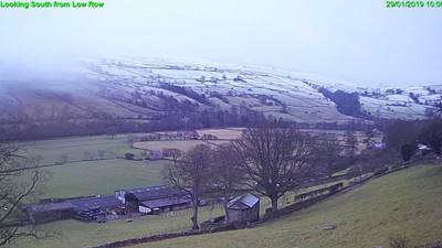
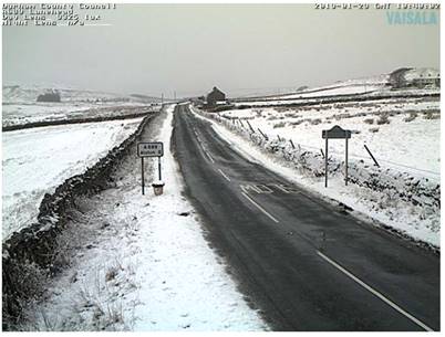
This is the west of County Durham at the moment…